You are hereLewis & Clark Forest Closures
Lewis & Clark Forest Closures
|
Lewis and Clark National Forest
1101 15th Street North
Great Falls, MT 59401 or
PO Box 869
Great Falls, MT 59403
Voice (406) 791-7754/Fax (406) 731-5302
|
 |
News Release
X Please Release On: May 26, 2011
Released by Dave Cunningham, Public Affairs Officer
Flooding, Rain, and Lingering Snow Forces Closure of Forest Roads, Trails, and Campgrounds in the Little Belt, Highwood, Big and Little Snowy, Castle, and North Portion of the Crazy Mountain Ranges

The combination of recent heavy rain and the melting runoff from an abnormally heavy lingering snowpack has caused many streams to overflow their banks causing widespread flooding and road damage across the Lewis and Clark National Forest. Effective May 25, 2011 campgrounds, roads, and trails in the Little Belt, Castle, Highwood, Big and Little Snowy and north half of the Crazy Mountain Ranges are closed to motorized use and camping. This closure does not apply to county roads although many county roads that access the forest have also been closed or sustained flood damage.
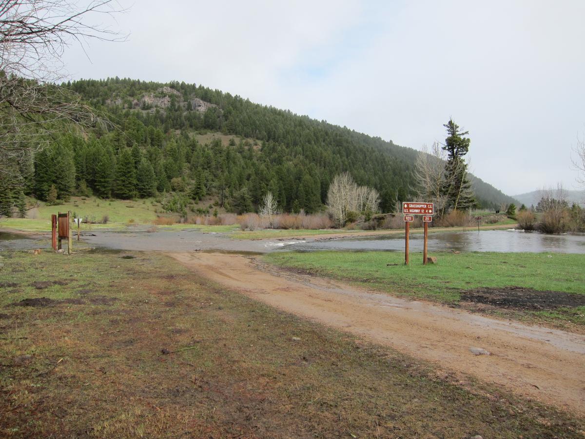
“In a normal year we would be looking forward to welcoming the season’s first wave of campers and the beginning of the summer recreation season, but unfortunately we cannot do that this year.” said White Sulphur Springs District Ranger Carol Hatfield. “Yesterday we had a crew working to open the Grasshopper campground in the Castles. When they arrived the campground was accessible and relatively dry. Over the course of several hours the crew experienced water conditions come up and begin to flood the campground. Today the culvert on the road leading into that campground has washed out and the campground has water in it. If anyone had been camping there they would be stranded in a flooded campground.”
“The two campgrounds that were potentially going to be open for the Memorial Day weekend, Aspen and Logging Creek Campgrounds, both lie within a floodplain and are vulnerable to flooding if Belt Creek or Logging Creek continue to rise.” said Belt Creek District Ranger Tina Lanier. “After working to get them open, we hated to close these campgrounds, but the fact that both campgrounds are identified as being at risk of flooding under the conditions that we are experiencing factored heavily in making this decision.”
This closure is being implemented primarily to protect human safety due to ongoing and anticipated flooding that is covering many campgrounds and recreation areas lying within the floodplains of streams and damaging or destroying sections of roads, culverts, and bridges across the Forest. As of May 25, the Natural Resource Conservation Service’s Water and Climate Center reports that the snow water equivalent (the amount of liquid water still held in the snowpack) in the Smith, Judith, and Musselshell river basins is 287% of the 30 year average. 

Many roads used to access the forest have sustained damage and are impassable. Other roads are still buried by snow. May 25 reporting from snotel sites located in area mountain ranges show widespread lingering snow with 48” of snow at Crystal Lake in the Big Snowies (elevation 6050 feet), additional reports from the Little Belt Range showed 14” of snow at the Deadman site (6450 feet), 21” of snow at the Stringer Creek site (6550 feet), 44” of snow at the Onion Park site (7410 feet), and 80” of snow at the Spur Park site (8100 feet).
The Forest will be evaluating these closures daily as conditions fluctuate. We intend to reopen roads, trails and campgrounds across the Forest as soon as possible, but with predicted precipitation, these closures are anticipated to remain in effect through the Memorial Day weekend. When we are able to reopen areas it is likely to progress in stages across the affected mountain ranges as areas dry out, high water recedes, and crews are able access and repair damaged areas. For additional information people should contact their local Forest Service Office.
| Attachment | Size |
|---|---|
| special-order-flood-closures-05262011.pdf | 71.99 KB |
